Blindgötu, cul-de-sac, sackgasse, the bottom of a bag – dead end doesn’t sound an attractive proposition whatever the language (Icelandic, French and German as well as English here).
To reach a dead end means you’re not making any progress, you’re unlikely to succeed, but this week, dead ends have literally been our focus.
Heading somewhere and knowing you are going to have to return the exact same way can be psychologically depressing. On a canal though, things tend to look very different heading in opposite directions. The distances remain the same, but even bridges and locks change in character and angle as well as the views, the wildlife, and the challenges.
Arms have a starting point and an end on canals as on bodies. The lockless Wendover Arm, for example, straddles the border of Hertfordshire and Buckinghamshire. Its 6.7-mile length was dug originally to enable water from Star Top Reservoir to be supplied to the summit of the Grand Junction Canal (now known as the Grand Union Canal). Opened in 1797 it became unnavigable in 1897 but volunteers from the Wendover Canal Trust have been painstakingly working for he 1.7 miles from Bulbourne Junction to a winding (turning) point just beyond a beautifully reconstructed Little Tring Bridge. This section (Phase 1) was handed over the Canal and River Trust in 2005 for them to manage the navigation.
After leaks and low water levels were reported in April this year, CRT took the decision to drain the Phase 1 section and set up stop planks (a stop lock) to hold back water from above Little Tring Bridge to the winding hole. According to the Wendover Canal Trust CRT have advised that repair works will cost £200,000 which they cannot afford for some years, particularly in light of significantly reduced government funding, and a statutory commitment in the area to spend £6million strengthening the embankments of Wilstone Reservoir. This is another hugely important reservoir for the Grand Union Canal, and the safety work to it needs doing under the Reservoir Act. Canal and River Trust are actually responsible for 71 reservoirs, most of which date back to the early 1800s. Their monthly published Reservoir Watch makes particularly interesting reading right now, as canals across the country are threatened with closure or restricted navigation because of a lack of water. The Grand Union South water holding at the moment is down by 1.5% in a month. Others where restrictions are in place like the Leeds and Liverpool Canal and Caldon Canal are seeing water levels in feeder reservoirs down by up to 10.7%. February and March this year were warmer and below average for rainfall. April 23rd was the last day we on our travels experienced any rain. Some reservoirs in the north are also being held at low levels because of work to them. It makes some boaters nervous, and for those unable to travel outside particularly affected regions because of work or fixed moorings, their capacity to travel at all is severely curtailed.

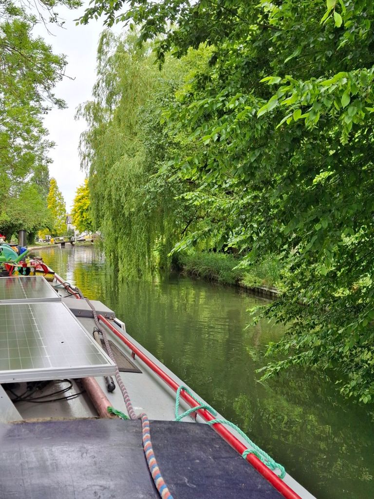
Because of the stoppage on the Wendover Arm, we found ourselves faced with a closed for navigation notice saying only vessels of up to 40ft (we’re 50ft) could navigate and turn a restricted length. We managed to back the boat out of Bulbourne Junction onto the Wendover and moored up to head off to explore on foot. I have to say, much as Boatdog appears to enjoy cruising on the boat, this was a preferable voyage of discovery for her!
Down through dappled shade, the narrow towpath took us between fields, with moorhens and ducks the only passengers on the canal, with a single kingfisher speeding above the water. The outskirts of Tring suddenly appeared with garden fences alongside us, and crossing over a humpbacked road bridge where the towpath changes sides, we were abruptly amid industry – in the form of Heygates Flour Mill which fronts the Wendover Arm, and curves along its length. The history of the mill is evident from its architecture. The newer section is near the road, and as the Arm and the mill continues, older brick buildings rise five stories high. The smell is of flour and something else – cleaning fluids perhaps?
Once past Heygates, the Arm returns to bucolic surroundings, fields and horses, arable crops, with the water’s edge full of abundant yellow flags and reeds. The water is clear and plant life below the water, evident. Within feet of the pumping station at Tringford though, it’s a very different matter. The canal bed is exposed beyond stop planks and pumps and very dry. The walk to the winding hole is one of discovery still – huge mussel shells, a gas canister, and ubiquitous plastic bottles.
We made it to the end of navigation – just without a boat!
The Aylesbury Arm on the other hand is a very different story – 6.25 miles and 16 locks opened in 1814 to enable the transport of grain, timber, coal and building materials to and from the market town. It too struggles with water these days – we were held by CRT at the top of the Arm whilst they adjusted water levels in the top pounds because many were low and one was almost completely dry. It is a task which needs to be done most days now, apparently.
Originally, the canal was intended to carry on from Aylesbury to join the River Thnames at Abingdon, but wealthy landowners not keen for a commercial enterprise wending its way through their acres put paid to that. It stopped at Aylesbury Basin, and there it stops today.
The first two locks from Marsworth Wharf are a staircase, the only staircase in the Southern Region, and what a delight it is to be back on narrow locks again! The 16 locks give insights into the history of this stretch, with names like Jeffries, Gudgeon Stream, Buckland, Osier Bed, and Hills & Partridge. The Arm threads its way up and down these locks between fields and woodland. These areas produced goods that filled the commercial boats, which plied the Arm until 1964 when the last cargo boat made its final journey.

The birdsong is only drowned out by the overflowing locks – a feature of the water management system for the waterway. Water for this canal comes mainly from the Marsworth Pound flowing down over the head gates, from Wilstone Reservoir via a sluice on Gudgeon Brook and from another brook further down. The locks carry boats 94 ft 8 inches down (or up) along the canal’s length.
The canal buildings at the Aylesbury Basin were extensive, including warehouses and at one stage a power station. Now mooring at the Basin is flanked by Buckinghamshire New University and Waitrose. Boats face the Waterside Theatre where comedian Ronnie Barker (taller of the two Ronnies) is remembered. He made his stage debut in 1948 in the town’s old County Theatre.

He’s not the only famous name linked to the town – Henry VIII allegedly wooed Anne Boleyn at the 14th century Kings Head whose wattle and daub walls and original glass are still attracting visitors (and drinkers) today. Yes, we visited – would have been rude not to!

So, dead ends we’ve discovered are far from depressing or bag-ends-of-nothing. They can be bag ends bulging with interest.
